What’s Peat Got To Do With It?

“We are talking about the peatlands. We see them as the breathing and cooling lands for the planet, [They are] the third-largest wetland in the world and one of richest carbon storehouses on Earth.” — Mushkegowuk Council Grand Chief, Jonathan Solomon

Written by: Joshua Ostroff

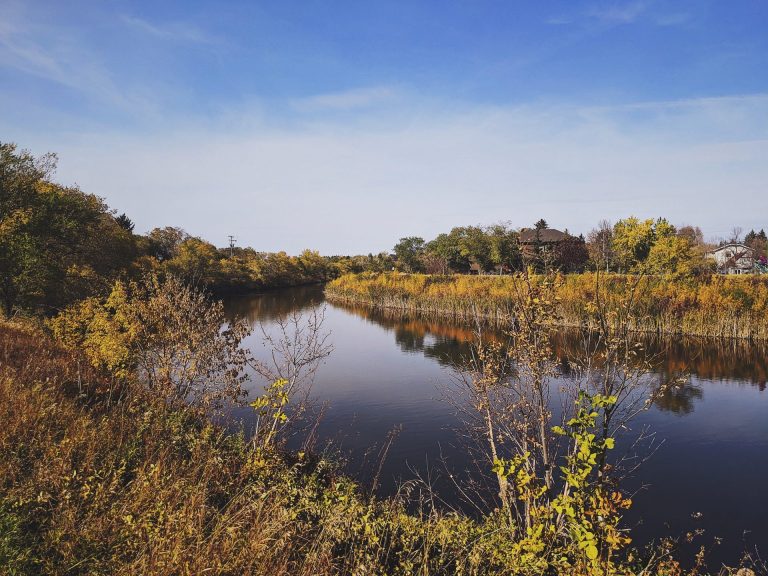
The Hudson and James Bay Lowlands, which sweep across northern Ontario and stretch into Manitoba and Quebec, are home to many Indigenous communities, including seven Mushkegowuk First Nations. They also host an incredible diversity of wildlife.

This region is pockmarked by dense peatlands, estimated to contain billions and billions of tonnes of carbon, accumulated over thousands of years.

What makes these lands so important is that the carbon is currently locked in place. It’s crucial that we keep these ecosystems intact and not make the climate crisis even worse by releasing this absolutely massive amount of stored carbon into the atmosphere.

But exactly how much is there, where it’s stored, and what will happen if industrial development and/or climate change disturbs it are still outstanding questions.

What are peatlands?

Peatlands are a type of wetland and include fens, bogs, and mires. They’re found in almost every country and cover about three per cent of the world’s land surface, including 13 per cent of Canada, where they store
approximately 147 billion tonnes of carbon.

Their name comes from the accumulation and burial of “peat” soil — organic plant material that is only partially decayed due to the waterlogged conditions of the ecosystem, which slows microbial decomposition.

To be considered a peatland, the area in question must be at least 40 centimetres deep. Over time, peat can reach depths of up to 10 metres, though it averages two metres deep in the Hudson and James Bay Lowlands. Peatlands store nearly twice as much carbon as all the world’s forests combined, and in northern Canada, one square metre of peatland contains about five times as much carbon as an equivalent area of Amazon rainforest.

To reap the climate benefits of peatlands, however, you have to keep the carbon in the ground. Globally, drained peatlands emit two gigatonnes of carbon dioxide each year, which is equivalent to five per cent of human-produced greenhouse gases or the annual output of 500 coal plants. Canada is home to a quarter of the world’s remaining peatland carbon stores, and much of that lies within Mushkegowuk traditional territories, which are part of one of the largest contiguous network of peatlands in the world.

What wildlife live in this region?


The traditional territory of the Mushkegowuk Cree extends from subarctic permafrost in the north, also home to polar bears, all the way to boreal forest in the region’s south, where you’ll find species like wolverine, caribou and lynx.

The middle swath of peatlands, a vast complex of wetlands and coastal areas, are also a globally important habitat for birds, from palm warblers and loons to a whole host of other migratory waterfowl and shorebirds.

It’s an area of importance in terms of climate change mitigation, but it also has tremendous biological and ecological value.

What wildlife live in this region?

The traditional territory of the Mushkegowuk Cree extends from subarctic permafrost in the north, also home to polar bears, all the way to boreal forest in the region’s south, where you’ll find species like wolverine, caribou and lynx.

The middle swath of peatlands, a vast complex of wetlands and coastal areas, are also a globally important habitat for birds, from palm warblers and loons to a whole host of other migratory waterfowl and shorebirds.

It’s an area of importance in terms of climate change mitigation, but it also has tremendous biological and ecological value.

What’s threatening the peatlands?


Short term: Upstream of Mushkegowuk territory is the so-called Ring of Fire, a hotbed of mineral deposits. In January 2021, the Chiefs of the Mushkegowuk Nations and the Grand Chief called for a development moratorium on mining and industrial roads until there’s a proper protection plan for sensitive wetlands and watersheds as well as gathering the necessary baseline information to understand the impact of industrial activities on carbon storage. A few months later, the Attawapiskat, Fort Albany and Neskantaga First Nations unilaterally declared a moratorium, stating their “Territories and Rights stand to be seriously and permanently desecrated by massive-scale mining in the Ring of Fire,” and adding that “the James Bay lowlands stand as one of the last and most important bastions of defence against climate collapse.”

Long term: If a peatland is disturbed, drained or altered, the stored carbon is released back into the atmosphere — shifting the ecosystem from a sink to a source of carbon dioxide. Methane is another prominent greenhouse gas found in peatlands, and it is nearly 30 times more powerful than carbon dioxide.

Consequently, rather than reducing the effects of climate change, these disturbed peatlands do the reverse and contribute to climate breakdown. This would not only jeopardize our progress on climate action, but further accelerate the climate crisis.

Protecting one of the world’s largest peatland complexes in the HJBL from releasing its stored carbon is critical not only for Mushkegowuk and the Omushkego people but also for our country’s climate targets and people around the planet. The lands are also critical to safeguarding wetland and coastal wildlife, including migratory birds, that call it home.

What’s next?

On request of the Mushkegowuk Council, community-led field sampling of these peatlands, designed to weave together both scientific research and Indigenous knowledge systems, will be done in partnership with researchers from WWF-Canada and the Remote Sensing Lab at McMaster University to help inform their stewardship decisions.

These efforts will help advance Indigenous-led conservation in a globally significant area for carbon storage, biodiversity and culture while delivering benefits to local communities. It will also provide important information to support decisions made in environmental assessments underway for the Ring of Fire, for which the Council is calling for a revised co-governance structure that goes beyond “duty to consult.”

And this carbon mapping and research will produce crucial data to help Canada prioritize nature-based climate solutions to achieve our greenhouse gas reduction targets, through both avoided emissions and active carbon sequestration. If done in concert with new Indigenous Protected and Conserved Areas, it could make a critical contribution to ensuring that Canada’s recently announced pledge to protect 30 percent of land and waters by 2030 is achieved in an equitable and inclusive way.